|
|||
|
The Bedouin Communities East of Jerusalem – A Planning Survey |
|||
|
●
Introduction Khan Al-Ahmar Communities ● Summary
|
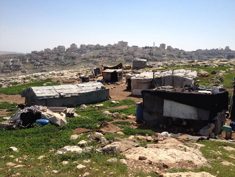
5. Jabal Al-Baba Community: Jahalin Tribe – the Salamat family Population: 40 families, approx. 320 residents Water: Independent hookup from Al-E’izariya and water tanks Electricity: Independent hookup from Al-E’izariya Sewage: none Education: Elementary and high schools in Al-E’izariya Medical services: Infirmary in Al-E’izariya Daily necessities: Al-E’izariya Religious building: none Cemetery: Al-E’izariya Flocks: approximately 400 heads of livestock
|
||
Identity Card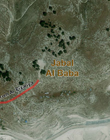 |
Chronoligical Development |
Planning Survey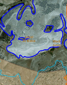 |
|
|
The community is located west of Ma’ale Adumim, and north of Al-E’izariya and the course of the separation barrier, in an area included in the Ma’ale Adumim enclave. Residents arrived at Jabal Al-Baba after evacuation and deportation from the Tel Arad area. Arriving in the area, they settled on state lands and on lands privately owned by residents of Al-E’izariya, with the agreement of the landowners. Today, some of the lands on which they reside have been declared as state lands. The houses are concentrated in three main clusters, which can be considered continuous building, at least since the beginning of the 1970s. In the mid 1990s, a number of demolition orders were issued for all structures there, but they were not implemented. The area is expansive and open, and there is no nearby Bedouin residential area or settlement. And yet, the area is included within the jurisdictional area of Ma’ale Adumim and E1, and following the plan to establish the separation barrier, the residents are expected to become trapped between the barrier and the roads, such that their possibilities for movement and accessible grazing areas will be drastically reduced.
In the past, residents would cultivate agricultural areas along the slopes of the wadi, but today, since construction of the barrier, this is no longer possible. The grazing areas have also been closed off to them, and today flocks can be grazed only in the immediate vicinity of the living area. The residents have flocks numbering 400 specimens, which are sufficient only for the manufacture of milk products for home use. In the past, they would also produce for trade and livelihood, but over time, they were forced to reduce the flock size, due to a lack of grazing lands, and increased hardship in traversing access roads. The residents receive assistance in the form of livestock vaccinations from the Palestinian Authority, and sometimes also receive animal feed. With the reduction in flock size, some of the resident began working outside of the locality, mainly in construction. Some of the men work in Al-E’izariya, and some in settlements in the area, but when work permits are not distributed employment rates in the community can reach as high as 80%. The women do not work at all outside of the home and the locality. Main planning constraints: – Includes state lands declared without an accepted arrangement regarding ownership and rights of usage – Located within the development and expansion plans for Ma’ale Adumim and E1 – Course of the separation barrier – Limitations on grazing lands and access to water sources |
|||