|
|||
|
The Bedouin Communities East of Jerusalem – A Planning Survey |
|||
|
●
Introduction Khan Al-Ahmar Communities ● Summary
|
10. Al-Fukara Community: Jahalin Tribe – Al-Faqir family Population: 7 families, approx. 50 residents Water: Water tanks; active well in the nearby area Electricity: Broken generator; solar panels Sewage: none Education: Schools in A’nata Medical services: Monthly arrival of mobile infirmary Daily necessities: A’nata and Ramallah Religious building: none Cemetery: Nabi Musa Flocks: approximately 130 heads of livestock
|
||
Identity Card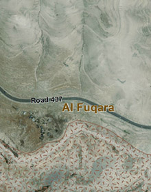 |
Chronoligical Development |
Planning Survey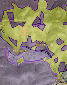 |
|
|
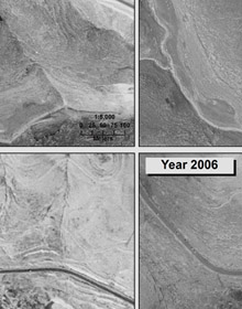
The community is located alongside and south of Road 437, which leads from Road No. 1 towards A’nata, west of Al-Khan Al-Ahmar, and southwest of the Kfar Adumim settlement. This community also arrived to the area after being deported from the Tel Arad area at the beginning of the 1950s. Residents first settled at a close distance to their present location but they were required to move to accommodate the opening of the quarry now located at the site. Following this, in 1982 they settled in their present place of residence. An historical analysis attests to continuous building since the 1980s. The community is located mainly on privately owned lands that belong to residents of A’nata, and predominantly outside the jurisdictional limits of Ma’ale Adumim and its development plans. A small segment sits on declared state lands within the Ma’ale Adumim limits.
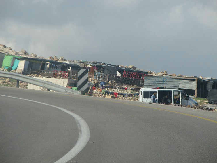
Flocks owned by residents provide sufficient milk products for domestic use only. The flocks rarely graze, but are kept all year long in pens, due to the prohibition and impossibility of reaching grazing areas, and they are sustained by feed, which is obtained at great cost. Residents work almost exclusively with livestock, but are essentially unable to make a living in this manner. A number of residents worked for many years in the nearby quarry, but all were laid off without compensation. There is a prohibition against cultivating land for agricultural purposes; the prohibition notwithstanding, a number of trees planted many years ago provide shade and recreation. Only some five boys and girls from the community attend schools, located in A’nata, to which they commute via organized transport. The number of children that attend educational institutions has been in steady decline over the years. The community, while located near the high-voltage line that serves the sewage treatment plant, is not connected to any infrastructure. The sewage infrastructure of many localities in the area passes through the nearby wadi, and the residents suffer from the stench and pollution. .Main planning constraints: – Included within the limits of the development and expansion plans for Ma’ale Adumim and E1 – Limitations on grazing lands and access to water sources |
|||